
From Wikipedia, the free encyclopedia


Commons

Commerce

Come See!

Bay St. Louis is a city in and the county seat of Hancock County, Mississippi, in the United States. Located on the Gulf Coast on the west side of the Bay of St. Louis, it is part of the Gulfport–Biloxi Metropolitan Statistical Area. The population was 9,284 at the 2020 census, up from 9,260 at the 2010 census.
History
.jpg)
The first European settlers in this area were French colonists, whose culture still influences the small city and who imported enslaved people from Africa. A Louisiana Creole population developed, featuring people of color as well as white colonists of largely French descent.
The county was organized by European Americans, who named it after John Hancock, who was a Founding Father of the United States. While more Protestant Americans migrated into this area after Indian Removal in the 1830s, there are still many Catholic families, some dating to both African and French ancestors of the colonial era. Roman Catholic schools still draw area students.
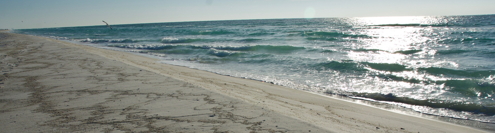
Geography
Bay St. Louis is located in southeastern Hancock County. It is situated on the west side of the Bay of St. Louis which empties into the Mississippi Sound, adjacent to Pass Christian to the east. The city is bordered to the north by the Jourdan River, the primary inlet of the bay and Diamondhead. The eastern border of the city is the Harrison County line in the middle of the bay.
According to the United States Census Bureau, the city has a total area of 26.6 square miles (69.0 km2), of which 14.7 square miles (38.1 km2) are land and 11.9 square miles (30.9 km2), or 44,82%, are water.
Hurricanes
On August 17, 1969, Hurricane Camille made landfall at the tip of Louisiana before continuing to Bay St. Louis.
On August 29, 2005, at 10:00 a.m. CDT, Hurricane Katrina made its final landfall just west of Bay St. Louis, at the mouth of the Pearl River, causing a 28-foot (8.5 m) storm surge. Hurricane Katrina came ashore during the high tide of 9:15AM, +2.3 feet more, causing a storm tide more than 30 feet (9.1 m) high.
USGS topographic maps show a common 25-foot (7.6 m) elevation contour line running throughout a ridge along the former routing of Highway 90 (Old Spanish Trail) on the western edge of the city. As higher ground, this area was spared inundation from the storm surge of Hurricane Katrina.
Katrina damaged more than 40 Mississippi libraries, including severe roof and water damage to the Bay St. Louis Public Library. The library reopened to the public on October 12, 2005.
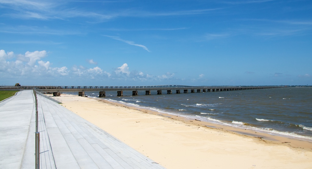
The Bay St. Louis Bridge on US Highway 90 was severely damaged, with many bridge sections down-dropped at the west edges. The destroyed bridge was replaced by a new Bay St. Louis Bridge, which received America’s Transportation Award. It includes a pedestrian bridge with an art walk featuring the works of local artists.
The underground utility infrastructure in Bay St. Louis received a federally funded total overhaul and replacement.[citation needed]
Climate
The climate in this area is characterized by hot, humid summers and generally mild to cool winters. According to the Köppen Climate Classification system, Bay St. Louis has a humid subtropical climate, abbreviated “Cfa” on climate maps.
Adjacent cities and towns
- Diamondhead (north)
- Gulfport (east)
- Pass Christian (east)
- Waveland (west)
Demographics
| Census | Pop. | Note | %± |
|---|---|---|---|
| 1880 | 1,978 | — | |
| 1890 | 1,974 | −0.2% | |
| 1900 | 2,872 | 45.5% | |
| 1910 | 3,388 | 18.0% | |
| 1920 | 3,033 | −10.5% | |
| 1930 | 3,724 | 22.8% | |
| 1940 | 4,138 | 11.1% | |
| 1950 | 4,621 | 11.7% | |
| 1960 | 5,073 | 9.8% | |
| 1970 | 6,752 | 33.1% | |
| 1980 | 7,850 | 16.3% | |
| 1990 | 8,063 | 2.7% | |
| 2000 | 8,209 | 1.8% | |
| 2010 | 9,260 | 12.8% | |
| 2020 | 9,284 | 0.3% | |
| U.S. Decennial Census[7] | |||

| Race | Num. | Perc. |
|---|---|---|
| White (non-Hispanic) | 6,996 | 75.36% |
| Black or African American (non-Hispanic) | 1,357 | 14.62% |
| Native American | 37 | 0.4% |
| Asian | 93 | 1.0% |
| Pacific Islander | 1 | 0.01% |
| Other/Mixed | 404 | 4.35% |
| Hispanic or Latino | 396 | 4.27% |
As of the 2020 United States census, there were 9,284 people, 5,447 households, and 4,273 families residing in the city.
Education
Almost all of the city of Bay St. Louis is served by the Bay St. Louis-Waveland School District. Small portions of land are within the Hancock County School District.
It is the home of Bay High School. In addition to Bay High, there are private Catholic schools: Saint Stanislaus College, a residency and day school for boys grades 7–12; and Our Lady Academy, a day school for girls grades 7–12. The latter two share some classrooms as well as a Roman Catholic curriculum.
All of Hancock County is in the service area of Pearl River Community College.
Media
The 1966 movie This Property is Condemned starring Natalie Wood and Robert Redford was filmed in Bay St. Louis, which was called “Dodson” in the movie, with some additional shooting in Biloxi, Mississippi, and New Orleans, Louisiana.
Infrastructure
Major highways
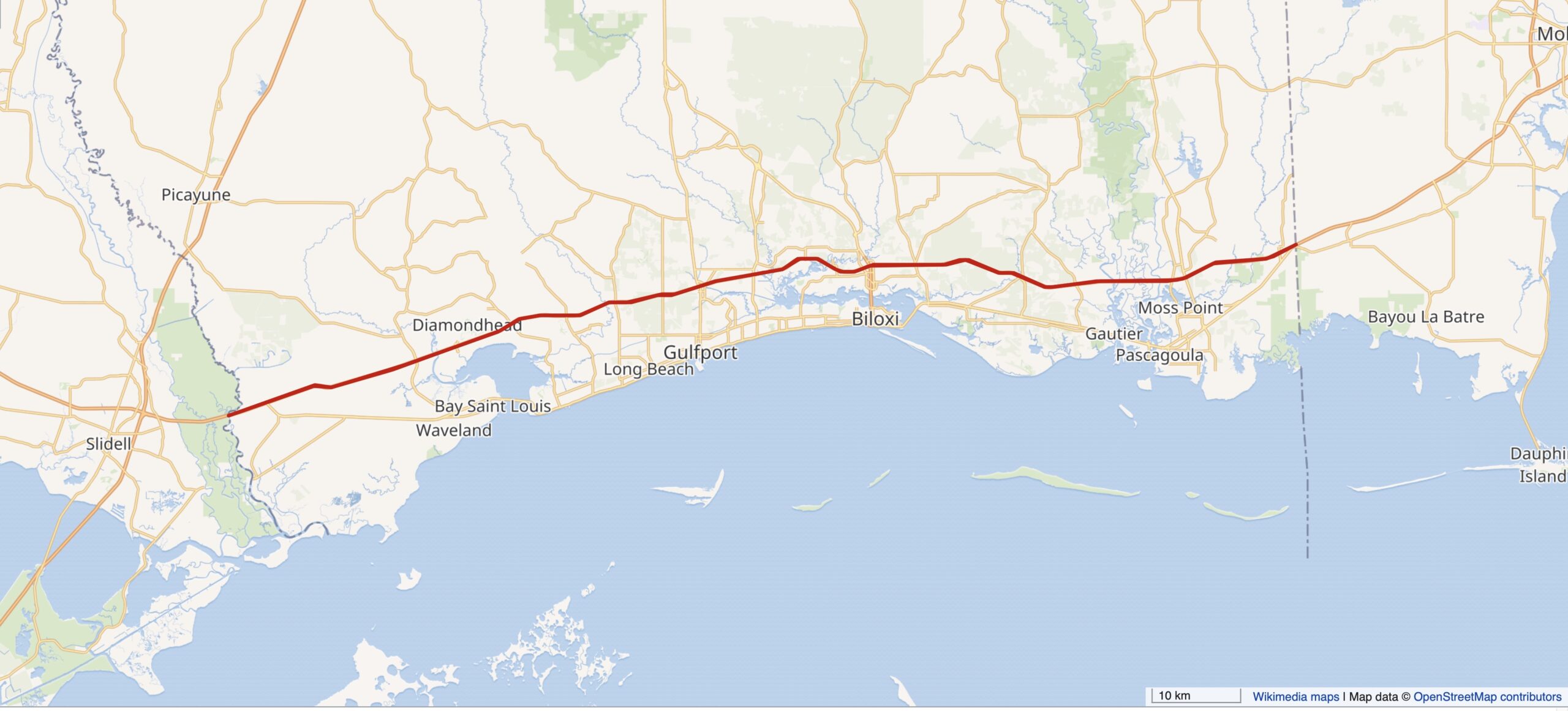
- Interstate 10 passes through the northern extension of the city, 10 miles (16 km) northwest of downtown, with access from Exit 13 (Highway 603). I-10 leads east 37 miles (60 km) to Biloxi and southwest 54 miles (87 km) to New Orleans.
- U.S. Highway 90 passes just north of downtown Bay St. Louis, leading east across the St. Louis Bay Bridge to Pass Christian. Via US 90 it is 15 miles (24 km) east to Gulfport and 60 miles (97 km) southwest to New Orleans.
- Mississippi Highway 603 runs along the western edge of the Bay St. Louis city limits, connecting US 90 and Interstate 10.
Notable people
- Stephen E. Ambrose, historian and author
- Richmond Barthé, sculptor associated with the Harlem Renaissance
- J. P. Compretta, former member of the Mississippi House of Representatives
- Leo Fabian Fahey, coadjutor bishop of the Diocese of Baker City, Oregon from 1948 until 1950
- Shannon Garrett, former professional Canadian football player
- Walter J. Gex III, United States district judge of the United States District Court for the Southern District of Mississippi
- Jacob Lindgren, MLB player
- Philip Moran, member of the Mississippi State Senate
- Alice Moseley, folk artist
- Leo Norris, former infielder for the Philadelphia Phillies
- Carlile Pollock Patterson, fourth superintendent of the United States Coast Survey (renamed the United States Coast and Geodetic Survey during his tenure)
- Albert J. Raboteau, is an African-American scholar of African and African-American religions
- Lawrence E. Roberts, pilot with the Tuskegee Airmen and colonel in the United States Air Force
- John Scafide, former offensive lineman for the Boston Redskins and mayor of Bay St. Louis from 1953 to 1969
- Caroline Snedeker, children’s author
- Gene Taylor, member of the United States House of Representatives from 1989 to 2011
- Tank Williams, former NFL player

